
ERS-2: Significant Wave Height
The Significant Wave Height over ocean surfaces is determined from the slope of the front in the radar altimeter wave form. The higher the waves, the more the returned signal is spread in time. Hence, a long delay between the first returns and a full signal return will result in a long and shallow in the wave form, which then indicates a high sea state.
The term Significant Wave Height refers to the wave height of the larger one third of the waves.
Over flat land or ice surfaces (such as the Sahara and Greenland) the altimeter is able to provide valid altimeter measurements, even in ocean mode. However, the inferred Significant Wave Height has no meaning.
The plot below shows the global distribution of the Significant Wave Height as measured by the ERS-2 Radar Altimeter. This data is extracted from the last 35 days of ESA URA fast-delivery products. The 1-per-second measurements are plotted as dots in this images, colour coded by the measured Significant Wave Height. After some minor screening of the 1-Hz measurements (on measurement every 1 second, in which time the satellite travels 7 kilometers).
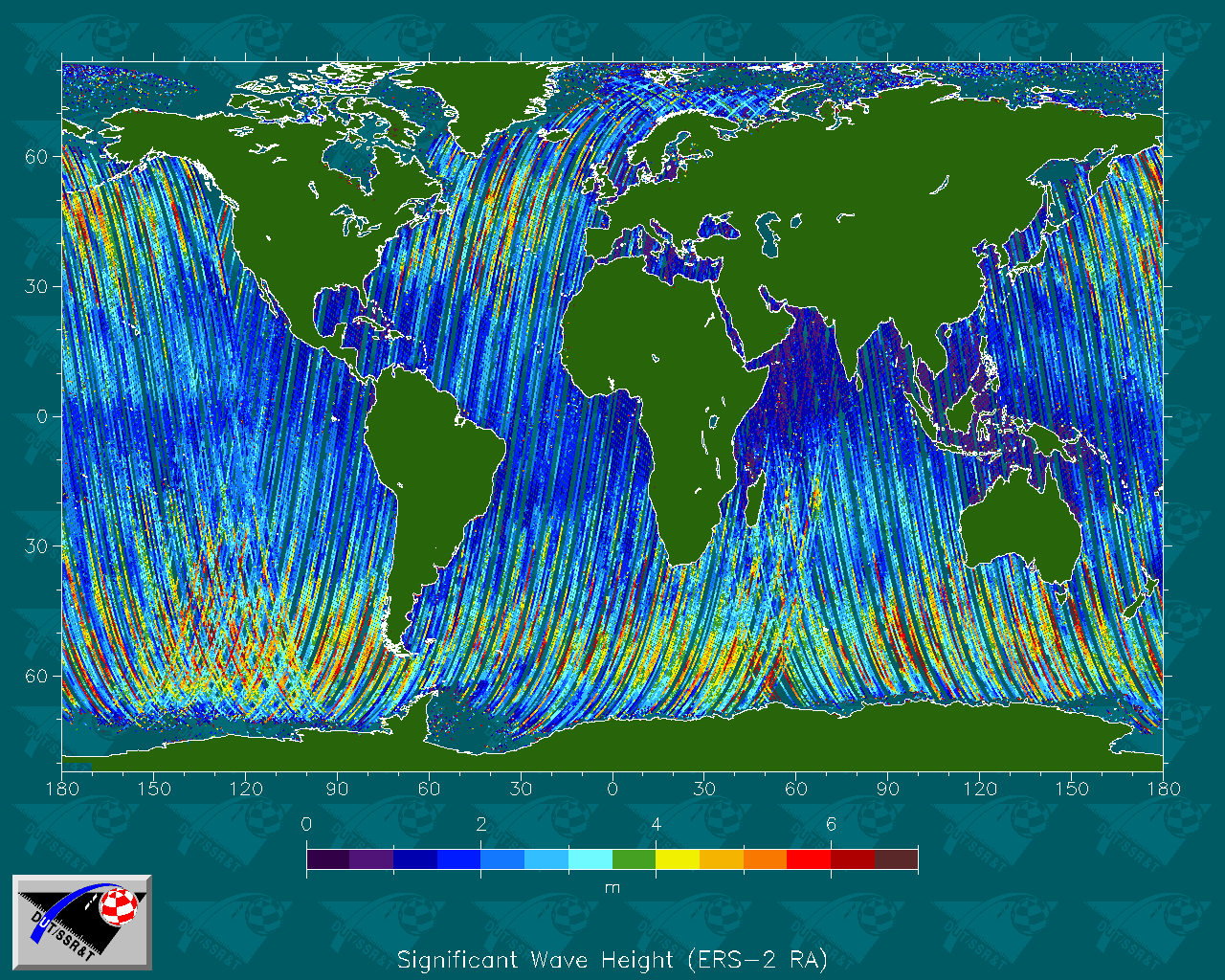
You may click the image to get an enlarged version (1280x1024 pixels).
More information
 |
The ERS satellites Information about the ERS satellites and their instrumentation, and more hyper links. |
|
ERS-2 information Information and pictures of the ERS-2 satellite. |
 This page is maintained by